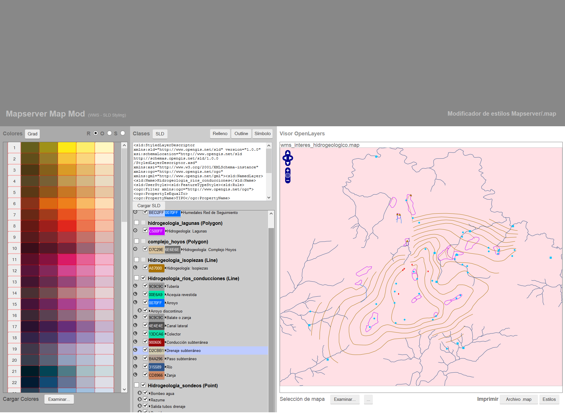
Mmmod is a web application developed in JavaScript that enables MapServer .map configuration files to be read, interpreted and edited. Its main purpose is to modify the styles of the map while visualizing the changes in real time using the OpenLayers open-source viewer.
The application was created to solve the problem of editing MapServer .map configuration files without having direct access to or the necessary resources to recreate the main WMS server.
The need to manually edit hundreds of text files combined with the inability to visualize these changes in real time made it impossible to directly modify the MapServer format without a tool with these characteristics.
Mmmod was developed in collaboration with Territoria.
User-friendly interface
User-friendly interface that optimizes screen space and maximizes productivity.
.map file parsing
Analyzes and interprets the text contained in the .map file and collects key information.
Real-time styling
Uses the OpenLayers viewer to display the style updates in real time.
SLD (Styled Layer Descriptor)
The application uses the OGC SLD/SE standard 1.0 to receive the updated style for each map element.
SLD editor
Gives the user total control over the parameters and values submitted to the WMS server.
Map color guide
A color guide has been especially designed to facilitate the task of styling maps.
Color gradient tool
Generates an interpolation between the first and last colors within the group of classes selected
Server independent
Anyone with an Internet connection is able to edit the styles on a map from outside the main server.
